I've been neglectful in my posting. It's amazing how exhausting this adventure stuff can be and quite honestly, I think I had run a little out of steam. When we started I would stay up until 1 or 2 in the morning and write updates while James snored beside me. But the ritual of setting up and taking down camp every day and long days of riding started to wear me out so something had to give for a bit. No complaints though - every bit has been absolutely amazing - a little bit of exhaustion and all.
For those of you that have been watching our spot tracker you'll notice that we are currently in Apple Valley, Minnesota. My last update was about the Cassiar Highway, but we have since gone through Canada's Jasper and Banff national parks as well as Glacier National Park in Montana. Both beautiful places and I have plenty to share about them. I've decided that it would be worth dedicating a trip just to British Columbia - there's so much beauty to see.
We've since been through Montana and North Dakota and we are currently visiting my aunt and cousins in Minnesota, an extra treat along the way. Staying just for one night, it's been good company, a warm bed and a clean load of laundry. We'll be off to Chicago tonight. My back tire isn't lasting as long as we had hoped and we'll have to do a swap there so I can make it home. James and I will split up on Friday. He will continue home and back to work to get ready to take off to OCS on August 13. I will head to Indianapolis to see my grandparents and aunt there for a couple of days. Then I'll make my way home on my own.
I'm hoping to catch up on the blogging while I'm in Indy. I really do have so much to share. More than just about the last few places that we've been, I have to tell you why this has been so amazing. I've had plenty of time to marinate on these things while riding. It's amazing how comtemplative you can get after several hundred miles on the bike. And being the rather "thinky" (as FuzzyGalore put it) individual I am I can get carried away.
More to come....
Thursday, July 30, 2009
Saturday, July 25, 2009
The Lost World
Cassiar Highway
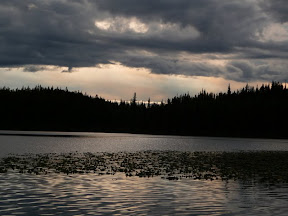
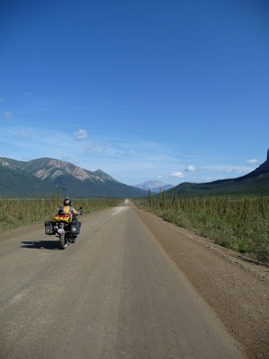
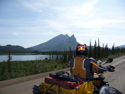
Along this trip we've seen some amazing things so far. It's hard to believe that things can keep getting better, but they do. The ride from Watson Lake down the Cassiar highway over to Stewart and Hyder (on the Alaska and Canada border) was absolutely phenomenal. It would be impossible to describe it to any degree of justice and I'm certainly no photographer. To my dismay, every time I take a photo of something that looks amazing in person it never quite captures it. I've developed a real appreciation for photographers that are able to capture these sorts of things, but I'm certainly not one of them. But in this instance, I know words and photos will fall short and I write this wishing I could bottle up a part of the Cassiar highway for you - it would be an amazing thing to share.
We stayed the night in Watson Lake, a small community along the Alaska highway that started by consequence of the building of the highway during WWII. Upon recommendation, we stayed at the historic Air Force Lodge, where we were greeted by the owners, Michael (pronounced Mic-ai-il in German) and his Austrian wife. Michael, a congenial, double-dimpled fellow, kindly requested us to remove our shoes, showed us the ropes and gave us the history of the building and his painstaking restoration of it. It was the only remaining one of over a hundred similar buildings erected to house the military during the construction of the highway. This particular building served as barracks for air force pilots, and although all the rooms and bathroom facilities are exactly where they were 70 years ago, everything has been redone and is simple, yet clean and comfortable.
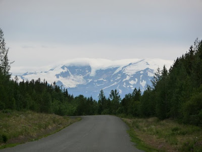
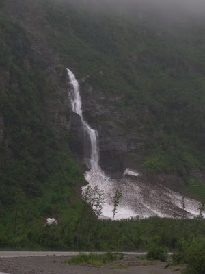
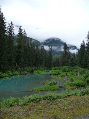
We made off from Watson Lake and very soon hit the Cassiar Highway. It was like stepping into a watercolor painting. The multi-hued slopes where anchored by trees of every shade of green. Wildflowers in bright colors line the road taking center stage as the foreground and background constantly compete for your attention. Waterfalls cascade from white capped mountains down rocky faces in to jade greens. We passed signs warning about avalanche areas and looking up could see fallen trees in rows down the slopes – victims of previous winters.
Some of the road was dirt, but most has been paved and I was left with the feeling that I could ride up and down that stretch and never tire of it. I often gasped in my helmet at something particularly beautiful, taking mental pictures that I'll keep with me forever.
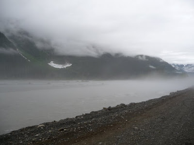
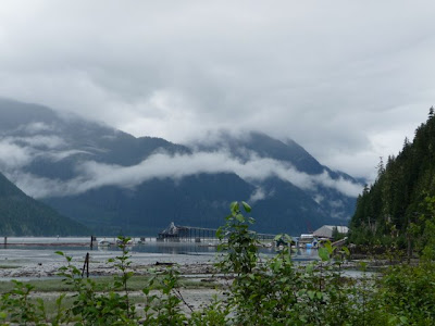
The road y's and we went right, towards Stewart and Hyder. The two towns, one in Canada and one in Alaska, are contiguous and it's difficult to tell where one stops and the other begins were it not for the small border crossing building. Here the Pacific Ocean creeps inland just a ways where it meets Stewart and Hyder. I'm not sure the history of this place, it's origins or beginnings, but just as I was thinking that it was very quickly on its way to becoming a ghost town I see a sign overhead that says, “Welcome to Hyder – the friendliest ghost town.” It truly looks like a lost world and you can see from the barren pilings sticking out of the misty water that this place once hosted busy piers and boardwalks. But now you might expect the Black Pearl ghost pirate ship to roll in at any moment.
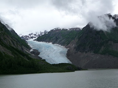
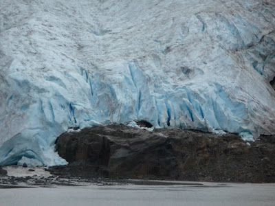
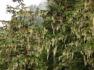
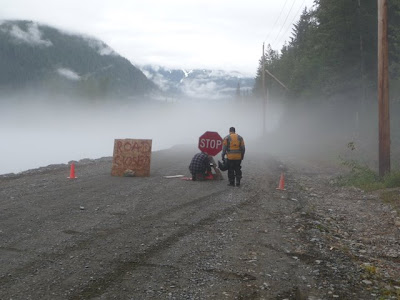
This place is beautifully mysterious, with thick cloud cover above and a soupy mist hanging just over the water. Between the grey, spruce and cedar now host hanging mosses in light greens. We stopped at the wildlife viewing area and then headed down the road a ways to see Salmon and Bear glaciers but the road was closed. We rode past the closed signs to see that the night before the road had been completely washed away. Powerful water rushes by below and you can hear large stones knocking against others as they are tumbled down the river, probably once part of the road. Not wanting to miss the glaciers, James had thought that maybe we could skirt around the edge. Taking a look, we decided that there was too little left and deeming the prospect way too pass or fail, we turned around and began heading back out to the Cassiar, to the point at which the road y'ed before. We still had about 100 miles to go for the day and forgetting how south we had traveled, we underestimated our amount of daylight and as it began to rain I had immediately regretted our decision to press on. Just as we started back out, two black bears ran out in front of James. James, putting the ABS to work, grabbed the brakes and had a thought flash through his head, as the brakes grappled with the demands, of him sliding up to the bear, disabled but alive and serving up dinner to the bear.
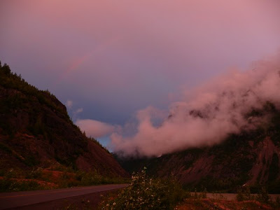
The bike remained composed and we continued on, making our way back out past glaciers and rivers. Just at the point where we could see the break in clouds ahead of us there was a rainbow. We stopped to try and take picture and noticed gentle upward breezes where raising the cloud cover. James remarked that the colors, somehow bright yet muted and misty at the same time, were like that of a dream.
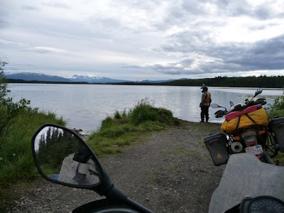
We made it to Meziandin Lake and camped for the night where James and I almost went to blows over the installation of our rain cover Kelty tarp. Funny thing about that dang tarp, that's meant to keep our tent and other gear dry when it's raining, is that of everything that's happened on this trip that dang tarp has the potential to be a divorce-in-a-bag. As soon as that tarp comes out my blood pressure rises and I've decided that James and I just have fundamental differences in our tarp erecting methodology. All that aside James and I managed to remain on speaking terms and we got a good night's rest.
The next morning just 50 miles or so from where we camped and we were off of the Cassiar. That which would ordinarily be considered quite pretty, in contrast was now, well, quite ordinary.
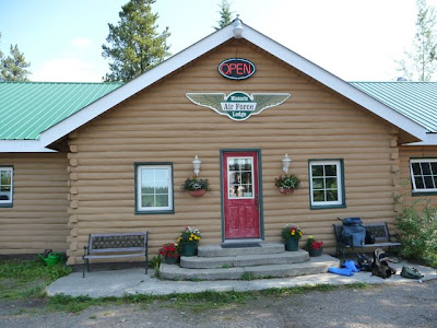
Our accommodations at Watson Lake:
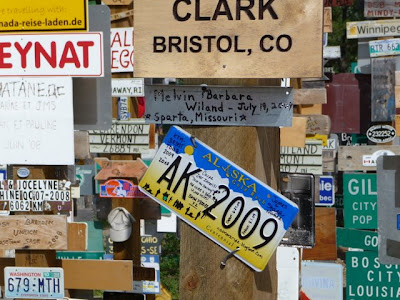
Adding our sign to the sign forest:
If you look closely you can see the rainbow:
Along this trip we've seen some amazing things so far. It's hard to believe that things can keep getting better, but they do. The ride from Watson Lake down the Cassiar highway over to Stewart and Hyder (on the Alaska and Canada border) was absolutely phenomenal. It would be impossible to describe it to any degree of justice and I'm certainly no photographer. To my dismay, every time I take a photo of something that looks amazing in person it never quite captures it. I've developed a real appreciation for photographers that are able to capture these sorts of things, but I'm certainly not one of them. But in this instance, I know words and photos will fall short and I write this wishing I could bottle up a part of the Cassiar highway for you - it would be an amazing thing to share.
We stayed the night in Watson Lake, a small community along the Alaska highway that started by consequence of the building of the highway during WWII. Upon recommendation, we stayed at the historic Air Force Lodge, where we were greeted by the owners, Michael (pronounced Mic-ai-il in German) and his Austrian wife. Michael, a congenial, double-dimpled fellow, kindly requested us to remove our shoes, showed us the ropes and gave us the history of the building and his painstaking restoration of it. It was the only remaining one of over a hundred similar buildings erected to house the military during the construction of the highway. This particular building served as barracks for air force pilots, and although all the rooms and bathroom facilities are exactly where they were 70 years ago, everything has been redone and is simple, yet clean and comfortable.
We made off from Watson Lake and very soon hit the Cassiar Highway. It was like stepping into a watercolor painting. The multi-hued slopes where anchored by trees of every shade of green. Wildflowers in bright colors line the road taking center stage as the foreground and background constantly compete for your attention. Waterfalls cascade from white capped mountains down rocky faces in to jade greens. We passed signs warning about avalanche areas and looking up could see fallen trees in rows down the slopes – victims of previous winters.
Some of the road was dirt, but most has been paved and I was left with the feeling that I could ride up and down that stretch and never tire of it. I often gasped in my helmet at something particularly beautiful, taking mental pictures that I'll keep with me forever.
The road y's and we went right, towards Stewart and Hyder. The two towns, one in Canada and one in Alaska, are contiguous and it's difficult to tell where one stops and the other begins were it not for the small border crossing building. Here the Pacific Ocean creeps inland just a ways where it meets Stewart and Hyder. I'm not sure the history of this place, it's origins or beginnings, but just as I was thinking that it was very quickly on its way to becoming a ghost town I see a sign overhead that says, “Welcome to Hyder – the friendliest ghost town.” It truly looks like a lost world and you can see from the barren pilings sticking out of the misty water that this place once hosted busy piers and boardwalks. But now you might expect the Black Pearl ghost pirate ship to roll in at any moment.
This place is beautifully mysterious, with thick cloud cover above and a soupy mist hanging just over the water. Between the grey, spruce and cedar now host hanging mosses in light greens. We stopped at the wildlife viewing area and then headed down the road a ways to see Salmon and Bear glaciers but the road was closed. We rode past the closed signs to see that the night before the road had been completely washed away. Powerful water rushes by below and you can hear large stones knocking against others as they are tumbled down the river, probably once part of the road. Not wanting to miss the glaciers, James had thought that maybe we could skirt around the edge. Taking a look, we decided that there was too little left and deeming the prospect way too pass or fail, we turned around and began heading back out to the Cassiar, to the point at which the road y'ed before. We still had about 100 miles to go for the day and forgetting how south we had traveled, we underestimated our amount of daylight and as it began to rain I had immediately regretted our decision to press on. Just as we started back out, two black bears ran out in front of James. James, putting the ABS to work, grabbed the brakes and had a thought flash through his head, as the brakes grappled with the demands, of him sliding up to the bear, disabled but alive and serving up dinner to the bear.
The bike remained composed and we continued on, making our way back out past glaciers and rivers. Just at the point where we could see the break in clouds ahead of us there was a rainbow. We stopped to try and take picture and noticed gentle upward breezes where raising the cloud cover. James remarked that the colors, somehow bright yet muted and misty at the same time, were like that of a dream.
We made it to Meziandin Lake and camped for the night where James and I almost went to blows over the installation of our rain cover Kelty tarp. Funny thing about that dang tarp, that's meant to keep our tent and other gear dry when it's raining, is that of everything that's happened on this trip that dang tarp has the potential to be a divorce-in-a-bag. As soon as that tarp comes out my blood pressure rises and I've decided that James and I just have fundamental differences in our tarp erecting methodology. All that aside James and I managed to remain on speaking terms and we got a good night's rest.
The next morning just 50 miles or so from where we camped and we were off of the Cassiar. That which would ordinarily be considered quite pretty, in contrast was now, well, quite ordinary.
Our accommodations at Watson Lake:
 |
| From pics - watson lake through Cassiar |
Adding our sign to the sign forest:
 |
| From pics - watson lake through Cassiar |
 |
| From pics - watson lake through Cassiar |
 |
| From pics - watson lake through Cassiar |
 |
| From pics - watson lake through Cassiar |
 |
| From pics - watson lake through Cassiar |
 |
| From pics - watson lake through Cassiar |
 |
| From pics - watson lake through Cassiar |
 |
| From pics - watson lake through Cassiar |
 |
| From pics - watson lake through Cassiar |
 |
| From pics - watson lake through Cassiar |
 |
| From pics - watson lake through Cassiar |
 |
| From pics - watson lake through Cassiar |
 |
| From pics - watson lake through Cassiar |
 |
| From pics - watson lake through Cassiar |
 |
| From pics - watson lake through Cassiar |
 |
| From pics - watson lake through Cassiar |
If you look closely you can see the rainbow:
 |
| From pics - watson lake through Cassiar |
 |
| From pics - watson lake through Cassiar |
 |
| From pics - watson lake through Cassiar |
Wednesday, July 22, 2009
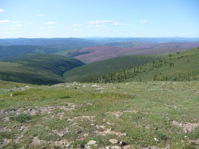
Look Ma, I'm on "Top of the World."
 |
| From pics - day 17-21 |
 |
| From pics - day 17-21 |
Fairbanks to Dawson City - Top of The World Highway
After our journey to Prudhoe Bay and back we stopped for the night in Fairbanks where we did laundry, removed a few layers of dirt off the bikes and changed the oil again. For as much as Anchorage impressed me, Fairbanks did not. It was an good place to get some maintenance done and find a pizza joint for dinner. We were still traveling with Detlif, the German doctor, since our paths were still heading in the same direction. The next day we wrapped up bike maintenance in the early afternoon and headed to Tok for a second time – this time heading in the opposite direction.
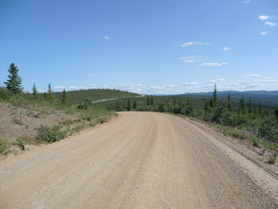
A night in Tok and back on the road – this time heading for the Top of the World highway. Top of the World highway runs from Chicken, AK to Dawson City, Yukon. Much of the road is dirt and during our stop in Chicken, a quaint prospecting town, I overheard many an RV-er complaining about the condition of the road – one in particular saying that it couldn't possibly get any worse. Nothing to concern ourselves with, the Dalton Highway veterans that we are....
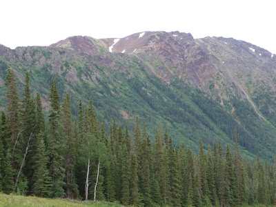
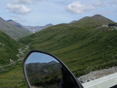
Most roads gracefully pick their way through a mountain range, skirting around mountains and through valleys, taking the easy road. But not this highway. It is constantly in search of the high ground, running across the tops of the mountains, affording expansive views of the valleys below and as far as the eye can see. You truly do feel “top of the world.” Not to mention this highway is also the most northernly highway in the world.
Just as we crossed into Canada we pulled over to a gravel pullout. We noticed a two-track jeep trail that meandered it's way across the mountains and into the distance. James, hopeful, looked at me and said, “I wonder where that goes....” Well, not wanting to disappoint the man, I said, “Wanna find out?” I don't think I'd finished saying it and he was already off – and I was in tow. Rocky with deep water-filled ruts it was great fun for about one and a half miles until we realized that it was heading completely in the opposite direction, it was getting late, and we still had to get the ferry over to Dawson City.
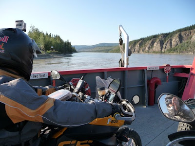
The only way to get into Dawson City from that direction is to cross the Yukon river by ferry – the way it's always been done. Dawson City was home of the Klondike Gold Rush. Here, in the late 1800's gold was found and with it a stampede of prospectors and others looking to cash in on the rush. The town looks much like I'd imagine it did then, never having paved the roads and keeping much of their historic buildings. We had dinner at Klondike Kate's and caught a bit of Diamond Tooth Gerdie's show with her cancan girls, entertaining in a G-rated version of the way I imagine many women did back in the gold rush days, having their turn at making a buck.
Before leaving Dawson City we took a detour up to Midnight Mountain, a dome that affords a 360 degree view of the city and surrounding country. From there we could see the Klondike river pour it's dark chocolate waters into that of the Yukon's milk chocolate. Although they merge into one, they continue with their own identities for quite some time and you can watch the line between the two waters trail along down the river before blending.
From Dawson City we'll head to Watson Lake and add our own sign to the Sign Forest I told you about before.
I've got a lot more catching up to do with the blog. More to come....
 |
| From pics - day 17-21 |
 |
| From pics - day 17-21 |
 |
| From pics - day 17-21 |
 |
| From pics - day 17-21 |
 |
| From pics - day 17-21 |
 |
| From pics - day 17-21 |
 |
| From pics - day 17-21 |
 |
| From pics - day 17-21 |
 |
| From pics - day 17-21 |
Friday, July 17, 2009
Veni, Vidi, Vici
Days 15 & 16
Sunday, July 12/Monday, July 13
Veni, Vidi, Vici
We came, we saw, we conquered.
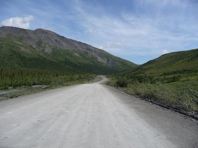
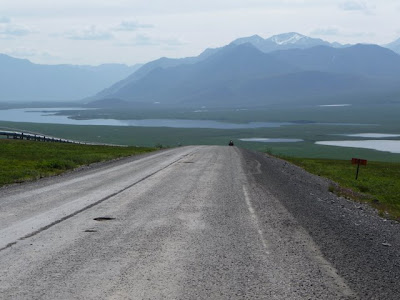
We'd come down to it. This is the adventure. We started the day outside of Coldfoot Camp with 240 miles of dirt and gravel between us and the Arctic Ocean.
When I close my eyes and imagine what Alaska might look like, this is it. All that I could imagine and more. The scenery is beautiful to the point of distraction – a dangerous thing when negotiating potholes, gravel and washboard road. Small forests of hardy trees set against green and rocky mountains with braids of streams cutting through beds of river rock. I've seen bigger mountains and bigger trees for sure, but there's something about the rugged beauty of this wilderness that's breathtaking. Just knowing that this arctic world sees temperatures of 80 below and hurricane force winds makes every bit of life this land sustains seem that much more amazing.
We were looking for a bit of a challenge and today the road did not disappoint. Loose gravel, thick mud, washboard, ruts and potholes. Trucks passing us coming from the opposite direction leave us in a whiteout of dust. There are a couple of patches of asphalt mixed in for a few miles for reprieve, but don't get lulled into a comfort zone because lest you forget, this is the Dalton Highway. Most the way is work, but fun, as I concentrate on looking as far ahead as possible to miss the bigger of the potholes on a constant quest for the smoothest blue groove. Parts where the gravel is deeper the bike floats along, vague and disconcertingly – but you can't slow down and whatever you do, don't touch the front brake. The mud makes the back end fishtail, back and forth and back again. This is almost fun until I hit particularly deep part which causes the front end to weave as well. Careful not to chop the throttle I ever-so-gently ease off and regain composure.
We made it to Deadhorse and are sitting here as I start writing this, just 10 miles south of Deadhorse where we've found a pull-off by the side of the road to make camp. We are next to the river as it's making its last 20 mile push to the Arctic Ocean. As far as the eye can see is flat arctic tundra and a maze of stamped marshes. The only thing interrupting it is the Dalton Highway, from which we came. The ocean breeze is whipping the tent around, but the wind affords much needed relief from the usual onslaught of mosquitoes. Camp is set and we've laid out our tarp for a place to sit as we enjoy a cup of single malt scotch with our friend Detlif, a doctor from Germany on his KTM.
Up at 5:30 to break camp and make it back to Deadhorse for the tour to the Arctic Ocean – the end of the road and as far north as we can go. Deadhorse is a maze of temporary buildings perched atop pads of dirt and gravel built up just above the tundra. A self sustaining mess of oilfield equipment, vehicles covered in dirt and hardy people. Rough country, the oil companies only allow their employees to work for 6 weeks at a time before sending them home to recover – but they are paid well for their efforts.
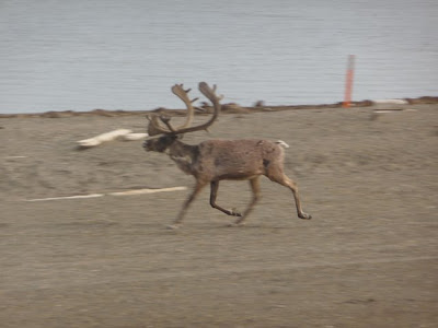
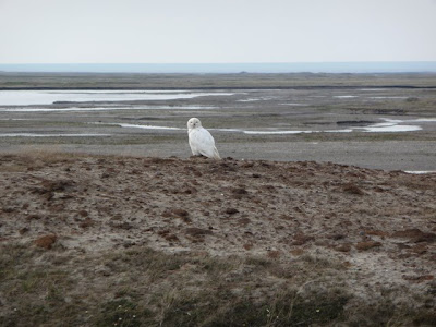
The arctic ocean around Prudhoe Bay was not as exciting as I'd imagined. The only ice to be seen was crusts forming along the beach where the water washes up on rocky shores littered with wood that washes up from Canada. The oil companies take care to minimize impact to the wildlife in the area, and Caribou that have used the area as migrating territory for centuries still make their way along the shore seeming unalarmed by the presence of this strange city. Seeing Prudhoe Bay, the turning back point of our adventure, only served to illustrate that this has never been about the destination, but rather the journey. And even though we are only half way through, it's been an amazing journey so far.
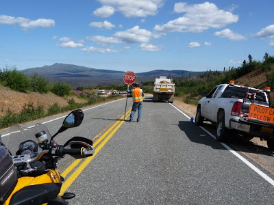
On the way back we discover the road is ever changing, and the road we went up was not the same as the road we went down. Parts that were okay on the way up, were bad on the way down and vice versa. There is constant maintenance to the road as man and machine pit itself against the extreme elements. In one particular place on the way back down there was a huge grading tractor in the lane, smoothing mounds of thick muddy gravel along the road. To the left, the tractor left a ridge of this gritty muck about a foot and a half tall. To get around the tractor you either had to risk crossing the mound to the left of the tractor or chance the ditch along the small edge to it's right. James, in front of me, chose left. What I'm sure was an attempt to go over the mound became a fight for life to make it through the mud, legs flailing side to side, bike trying to buck him off, and fighting to regain control. Because James is the more experienced rider I'm more than happy to let him pick his way through first as I carefully watch his lines and consequent success, or failure. I knew better than to try to replicate James' attempt at conquering the ridge so I went to the right of the tractor – the driver blaring his horn at me in anger. I could have explained that he might have been spending the day peeling me out of the mud if I'd gone the other way, but decided it just to acknowledge him with a wave and move on by – at least I'm not in the mud.
As for the difficulty of the road, there are good patches and bad patches – even a little pavement. But I wouldn't want to spoil it for you, and I'll leave it to you to discover. Besides, only those that travel it should really get to know.
The ride back fills me with deep satisfaction. For me, I no longer have to wonder if I have the grit to do it. For both of us it's the completion of a fun challenge that many only dream of. There's certainly more to come, but even if this was the end of the journey, I could go home satisfied. But on we go.
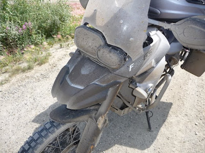
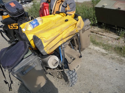
Glorious dirt – a badge of honor :)
Lucy the dog is riding with her daddy from Deadhorse all the way down to Mexico. Apparently she didn't get the memo that in this part of the world dogs do the pulling....
We camped next to the fire department's temporary heli base on the way back down at the Yukon River.
Sunday, July 12/Monday, July 13
Veni, Vidi, Vici
We came, we saw, we conquered.
We'd come down to it. This is the adventure. We started the day outside of Coldfoot Camp with 240 miles of dirt and gravel between us and the Arctic Ocean.
When I close my eyes and imagine what Alaska might look like, this is it. All that I could imagine and more. The scenery is beautiful to the point of distraction – a dangerous thing when negotiating potholes, gravel and washboard road. Small forests of hardy trees set against green and rocky mountains with braids of streams cutting through beds of river rock. I've seen bigger mountains and bigger trees for sure, but there's something about the rugged beauty of this wilderness that's breathtaking. Just knowing that this arctic world sees temperatures of 80 below and hurricane force winds makes every bit of life this land sustains seem that much more amazing.
We were looking for a bit of a challenge and today the road did not disappoint. Loose gravel, thick mud, washboard, ruts and potholes. Trucks passing us coming from the opposite direction leave us in a whiteout of dust. There are a couple of patches of asphalt mixed in for a few miles for reprieve, but don't get lulled into a comfort zone because lest you forget, this is the Dalton Highway. Most the way is work, but fun, as I concentrate on looking as far ahead as possible to miss the bigger of the potholes on a constant quest for the smoothest blue groove. Parts where the gravel is deeper the bike floats along, vague and disconcertingly – but you can't slow down and whatever you do, don't touch the front brake. The mud makes the back end fishtail, back and forth and back again. This is almost fun until I hit particularly deep part which causes the front end to weave as well. Careful not to chop the throttle I ever-so-gently ease off and regain composure.
We made it to Deadhorse and are sitting here as I start writing this, just 10 miles south of Deadhorse where we've found a pull-off by the side of the road to make camp. We are next to the river as it's making its last 20 mile push to the Arctic Ocean. As far as the eye can see is flat arctic tundra and a maze of stamped marshes. The only thing interrupting it is the Dalton Highway, from which we came. The ocean breeze is whipping the tent around, but the wind affords much needed relief from the usual onslaught of mosquitoes. Camp is set and we've laid out our tarp for a place to sit as we enjoy a cup of single malt scotch with our friend Detlif, a doctor from Germany on his KTM.
Up at 5:30 to break camp and make it back to Deadhorse for the tour to the Arctic Ocean – the end of the road and as far north as we can go. Deadhorse is a maze of temporary buildings perched atop pads of dirt and gravel built up just above the tundra. A self sustaining mess of oilfield equipment, vehicles covered in dirt and hardy people. Rough country, the oil companies only allow their employees to work for 6 weeks at a time before sending them home to recover – but they are paid well for their efforts.
The arctic ocean around Prudhoe Bay was not as exciting as I'd imagined. The only ice to be seen was crusts forming along the beach where the water washes up on rocky shores littered with wood that washes up from Canada. The oil companies take care to minimize impact to the wildlife in the area, and Caribou that have used the area as migrating territory for centuries still make their way along the shore seeming unalarmed by the presence of this strange city. Seeing Prudhoe Bay, the turning back point of our adventure, only served to illustrate that this has never been about the destination, but rather the journey. And even though we are only half way through, it's been an amazing journey so far.
On the way back we discover the road is ever changing, and the road we went up was not the same as the road we went down. Parts that were okay on the way up, were bad on the way down and vice versa. There is constant maintenance to the road as man and machine pit itself against the extreme elements. In one particular place on the way back down there was a huge grading tractor in the lane, smoothing mounds of thick muddy gravel along the road. To the left, the tractor left a ridge of this gritty muck about a foot and a half tall. To get around the tractor you either had to risk crossing the mound to the left of the tractor or chance the ditch along the small edge to it's right. James, in front of me, chose left. What I'm sure was an attempt to go over the mound became a fight for life to make it through the mud, legs flailing side to side, bike trying to buck him off, and fighting to regain control. Because James is the more experienced rider I'm more than happy to let him pick his way through first as I carefully watch his lines and consequent success, or failure. I knew better than to try to replicate James' attempt at conquering the ridge so I went to the right of the tractor – the driver blaring his horn at me in anger. I could have explained that he might have been spending the day peeling me out of the mud if I'd gone the other way, but decided it just to acknowledge him with a wave and move on by – at least I'm not in the mud.
As for the difficulty of the road, there are good patches and bad patches – even a little pavement. But I wouldn't want to spoil it for you, and I'll leave it to you to discover. Besides, only those that travel it should really get to know.
The ride back fills me with deep satisfaction. For me, I no longer have to wonder if I have the grit to do it. For both of us it's the completion of a fun challenge that many only dream of. There's certainly more to come, but even if this was the end of the journey, I could go home satisfied. But on we go.
 |
| From pics-day15-16 |
 |
| From pics-day15-16 |
 |
| From pics-day15-16 |
 |
| From pics-day15-16 |
 |
| From pics-day15-16 |
 |
| From pics-day15-16 |
 |
| From pics-day15-16 |
 |
| From pics-day15-16 |
 |
| From pics-day15-16 |
 |
| From pics-day15-16 |
 |
| From pics-day15-16 |
Glorious dirt – a badge of honor :)
 |
| From pics-day15-16 |
 |
| From pics-day15-16 |
 |
| From pics-day15-16 |
Lucy the dog is riding with her daddy from Deadhorse all the way down to Mexico. Apparently she didn't get the memo that in this part of the world dogs do the pulling....
 |
| From pics-day15-16 |
We camped next to the fire department's temporary heli base on the way back down at the Yukon River.
 |
| From pics-day15-16 |
 |
| From pics-day15-16 |
Monday, July 13, 2009
The Last Great Highway on Earth
Day 15 – Saturday, July 11
Dalton Highway
“Over four hundred miles of gravel, winding through the arctic wilderness. The lifeline of the Trans Alaska Pipeline, driveway for rural residents, and gateway to Earth's most magnificent wilderness region. Truckers, miners, and indigenous residents working together against the elements to help each other subsist. More traveled by caribou than man. The last great highway on Earth.” - quote found at the Yukon River Camp
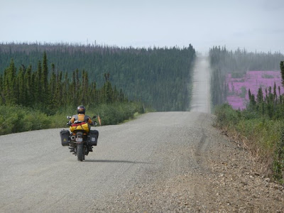
We left Fairbanks, a new day, a fresh start. Yesterday was rough for me. Nothing particularly challenging about the ride or the day, I was just tired and struggled to stay alert for most of it. One of the things I love about motorcycle riding is that, even 2 weeks into the trip, getting on the bike in the morning is like pressing the refresh button. There's no lingering fatigue from the day before and you can hop on feeling ready to go. Just eighty miles out of Fairbanks we hit the Dalton Highway, also known as the Haul Road and so named for the industrial trucks that haul equipment and supplies for the pipeline. First rule of the road: yield to big trucks.
The sign for the Dalton Highway is littered with stickers and names of people that have been before – like us, seeing this as one of the last big adventures to be had in Northern America. Immediately following are yellow warning signs cautioning that the pavement ends and that commercial trucks frequent the highway – we stop to take a picture. This road will lead to the arctic circle.
The road is of course dirt, but surprising easy to navigate at this point and the miles fly by with the biggest challenge staying far enough behind James to avoid being engulfed in the trail of dust that lingers behind him like the contrail of a jet plane. We watch the pipeline snake across the landscape, looking like a never-ending tube slide at a water park. Everything else is pristine and the pipe, oddly enough, looks in place with its own young history and mystique. It is, after all, the reason why we can come this far north by land – and this is truly and amazing wilderness to see.
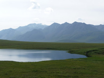
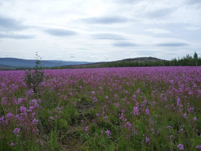
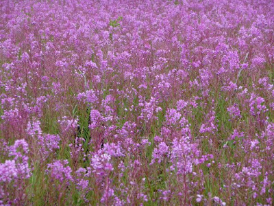
We ride through Boreal forest – a mix of spruce, aspen and birch - the southern face of the slopes denser because of the more generous share of sunlight they receive. Permafrost creates marshes and bogs where green grass grows tall. Fire is a part of the life cycle here, and looking across the hills you can see where fires have burned their way through the forests, seeming to selectively choose a narrow path, burning some and leaving other parts untouched. Patches are covered with fireweed flowers in dense blankets. The name for fireweed originally perplexed us, as it's neither red nor orange, but rather a pretty pinkish-purple. Now the name is now longer a mystery as it's clear that these flowers brightly spring up for morale where fire has left it's mark. Some of the mountains are completely covered in purple.
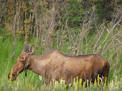
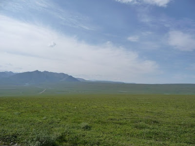
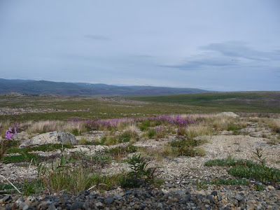
We reach the Arctic Circle, marked by a wooden sign at a turnoff on the road. Here in summer, the sun takes a never-ending bow along the horizon, but never really sets. Just within and with a change in elevation we reach the arctic tundra. Within minutes the trees disappear and what's left is an landscape of lichen-covered rocks and hardy, low-lying shrubs and flowers. This is caribou country and the home of the musk ox, wolf, arctic fox, arctic hare and of course, bear.
We reach Cold Foot Camp – a stop along the road that's not big enough to claim itself a town. We stop at the gas station/general store/motel/restaurant for dinner and to gas up. Across the road, and the only other thing in town is a visitor center. It was a beautiful interpretive center with amazing displays and helpful locals.
One of the displays had some alarming advice about dealing with bears: If a bear is on the defensive, stay calm and speak to it in a calming manner. If it continues and makes an attack you should lay face down and play dead with your legs apart so that he can't flip you over. If the bear starts to feed on you, you should fight back, because now the bear is no longer in a defensive mode, but rather a predatory one.
Ya think? I'm not making that up.
At the visitor center, we received advice on where to camp and met a German fellow on a KTM that we are camping with. All is well and the road from here promises to get a bit more challenging. Word is the Brook mountain range pass is covered in 2 inches of mud. Looking forward to tomorrow it will be difficult to sleep despite our weariness.
Dalton Highway
“Over four hundred miles of gravel, winding through the arctic wilderness. The lifeline of the Trans Alaska Pipeline, driveway for rural residents, and gateway to Earth's most magnificent wilderness region. Truckers, miners, and indigenous residents working together against the elements to help each other subsist. More traveled by caribou than man. The last great highway on Earth.” - quote found at the Yukon River Camp
 |
| From pics-day15-16 |
We left Fairbanks, a new day, a fresh start. Yesterday was rough for me. Nothing particularly challenging about the ride or the day, I was just tired and struggled to stay alert for most of it. One of the things I love about motorcycle riding is that, even 2 weeks into the trip, getting on the bike in the morning is like pressing the refresh button. There's no lingering fatigue from the day before and you can hop on feeling ready to go. Just eighty miles out of Fairbanks we hit the Dalton Highway, also known as the Haul Road and so named for the industrial trucks that haul equipment and supplies for the pipeline. First rule of the road: yield to big trucks.
The sign for the Dalton Highway is littered with stickers and names of people that have been before – like us, seeing this as one of the last big adventures to be had in Northern America. Immediately following are yellow warning signs cautioning that the pavement ends and that commercial trucks frequent the highway – we stop to take a picture. This road will lead to the arctic circle.
The road is of course dirt, but surprising easy to navigate at this point and the miles fly by with the biggest challenge staying far enough behind James to avoid being engulfed in the trail of dust that lingers behind him like the contrail of a jet plane. We watch the pipeline snake across the landscape, looking like a never-ending tube slide at a water park. Everything else is pristine and the pipe, oddly enough, looks in place with its own young history and mystique. It is, after all, the reason why we can come this far north by land – and this is truly and amazing wilderness to see.
We ride through Boreal forest – a mix of spruce, aspen and birch - the southern face of the slopes denser because of the more generous share of sunlight they receive. Permafrost creates marshes and bogs where green grass grows tall. Fire is a part of the life cycle here, and looking across the hills you can see where fires have burned their way through the forests, seeming to selectively choose a narrow path, burning some and leaving other parts untouched. Patches are covered with fireweed flowers in dense blankets. The name for fireweed originally perplexed us, as it's neither red nor orange, but rather a pretty pinkish-purple. Now the name is now longer a mystery as it's clear that these flowers brightly spring up for morale where fire has left it's mark. Some of the mountains are completely covered in purple.
We reach the Arctic Circle, marked by a wooden sign at a turnoff on the road. Here in summer, the sun takes a never-ending bow along the horizon, but never really sets. Just within and with a change in elevation we reach the arctic tundra. Within minutes the trees disappear and what's left is an landscape of lichen-covered rocks and hardy, low-lying shrubs and flowers. This is caribou country and the home of the musk ox, wolf, arctic fox, arctic hare and of course, bear.
We reach Cold Foot Camp – a stop along the road that's not big enough to claim itself a town. We stop at the gas station/general store/motel/restaurant for dinner and to gas up. Across the road, and the only other thing in town is a visitor center. It was a beautiful interpretive center with amazing displays and helpful locals.
One of the displays had some alarming advice about dealing with bears: If a bear is on the defensive, stay calm and speak to it in a calming manner. If it continues and makes an attack you should lay face down and play dead with your legs apart so that he can't flip you over. If the bear starts to feed on you, you should fight back, because now the bear is no longer in a defensive mode, but rather a predatory one.
Ya think? I'm not making that up.
At the visitor center, we received advice on where to camp and met a German fellow on a KTM that we are camping with. All is well and the road from here promises to get a bit more challenging. Word is the Brook mountain range pass is covered in 2 inches of mud. Looking forward to tomorrow it will be difficult to sleep despite our weariness.
 |
| From pics-day15-16 |
 |
| From pics-day15-16 |
 |
| From pics-day15-16 |
 |
| From pics-day15-16 |
 |
| From pics-day15-16 |
 |
| From pics-day15-16 |
 |
| From pics-day15-16 |
 |
| From pics-day15-16 |
Subscribe to:
Posts (Atom)